Planning for the Watershed: How Mitigation Credits Relate To Ecosystem Function
Because the mitigation banking industry developed from a need to regulate the dredging and filling of wetlands, the industry derives its most well-known name from this ecosystem.
However, “wetland” mitigation generally acts as a catch-all term for mitigation of a community of ecosystems that support the watershed. This allows for a broader application of environmental compensation to different regions of a watershed.
What impacts the boundaries of a watershed?
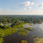
Wetlands are the transitional zone between aquatic and terrestrial ecosystems. This transitional zone occurs on the surface of the land like at a coastline where dune systems meet the ocean in the intertidal zone. It also occurs below the surface where groundwater and surface water meet at the water table.
The above-surface transition defines the borders of wetlands. The below-surface transition defines the bottom boundary of the watershed. The watershed is also bound by its catchment area, meaning the area of land that collects precipitation.
The needs of a watershed and landscape connectivity
In 2001, the National Research Council issued a report entitled ‘‘Compensating for Wetland Losses Under the Clean Water Act’’ which found fault with the methodology of determining service areas for wetland mitigation. This led to a proposed rule issued by the Department of the Army and the Environmental Protection Agency in 2006. This rule established what is known as the Watershed Approach for compensatory mitigation.
The Watershed Approach changed things. It set the precedent that federal mitigation site selection should consider the following when making mitigation decisions:
- an analysis of the needs of a watershed,
- “habitat requirements of important species,” and
- data on current trends in habitat loss
In Florida, compensatory mitigation may be needed for any land that supports the function of a wetland, this can include upland ecosystems and submerged land like freshwater springs. The location of a potential permit site or mitigation bank is affected by the surrounding lands.
A mapping of adjacent land use and community support is needed for any impact permits. This mapping determines the relative value of the land to the surrounding ecosystems.
How the landscape shapes the hydrology of the watershed
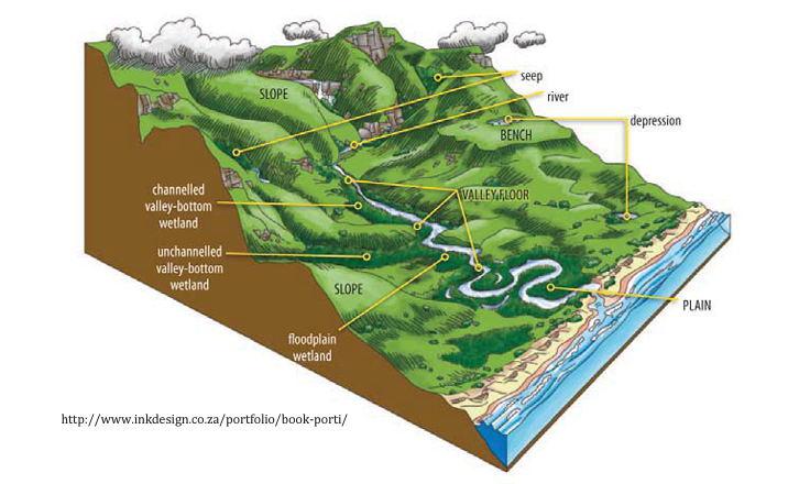
The composition of the land and land use at each section of the watershed determines its hydrological connection. The health of the watershed is defined by topography, aka “the lay of the land” and how water drips through it.
The watershed consists of patterns of elevation and drainage that transition water between aquatic ecosystems and through the terrestrial landscape. In a simplified version, it’s a series of funnels and channels carved into the landscape by natural processes or artificially made by man.
High elevation creates ridges that drain surface water through sloping lands to a depression or sea level. Rivers, lakes, ponds, streams, drainages, marsh, swamp, salt flats, wet prairies, mangroves collect and store water in times of floods, release water in times of drought, and generally stabilize the interaction between surface water, ground water, and salt water.
The water that flows through the land comes from rainfall, storm surge & aquifer discharge.
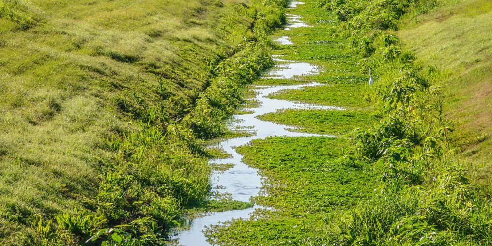
Surface water is hydrologically connected via a series of channels and tunnels where you can see the water pass through the land, like in drainage ditches or within subsurface water movement that passes through soil. Drainage branches are like the branches of a tree; smaller branches combine into larger branches as you get lower down in the watershed.
The watershed impacts groundwater recharge
Different areas of the watershed have different plant, soil, and water characteristics. Plant matter and soil composition have a big effect on wetland creation. Wetlands have more porous soils that allow for water to permeate and saturate the ecosystem.
In Florida, the porous limestone landscape, known as karst, allows for a lot of surface water to seep below the surface into groundwater, making the Florida aquifer one of the most productive in the country and the regulation of surface water very important for the health of groundwater.
Because of the nature of Florida’s geology, exchange between groundwater and surface water is highly productive. Groundwater seeps through rock, the more porous the rock is, the larger the aquifer.
Over the top of Florida’s crust is a layer of carbonate rock, like limestone. Carbonate rocks are formed from the skeletons of marine animals and developed in Florida over the course of millions of years. Natural acids eat away at the carbonate rocks, forming caves, deep caverns, and sinkholes that Florida is renowned for in a process called karsification.
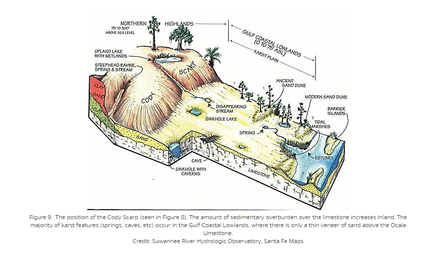
After the carbonate layer formed, a layer of silicate material, like sand, silt, and clay, formed over top. This is a relatively impermeable layer, which contains the aquifer below. In the lowlands and the karst plains where there is less of an impermeable layer of sediment, we find estuaries, depressional wetlands, tidal wetlands, and lots of hydrologic features.
Watershed cumulative effects assessment
The delineation between surface waters and ground waters is important for jurisdiction. While surface and groundwater interact in some wetlands that interact with a high water table, the authority to regulate these types of water is given to different public agencies.
However, the one unifying factor of regulation over both ground and surface water is an analysis of toxic load for the entirety of the water cycle, above and below ground. Section 303 of the Clean Water Act imposes an Impaired Waters Rule. This sets levels of water pollution low enough to avoid deterioration of water quality.
What is the main purpose of a watershed?
The goal of slowing and collecting water at different levels in the watershed is for it to slowly seep into the soils, to reduce the force of the water and the associated erosion of the landscape, and recharge the water table. With success, water flows through the landscape slowly, creating hydrated soils, habitat, and plenty of organic matter that acts as a nutrient buffer.
The benefits of a healthy planned watershed is water flow and nutrient flow. Vegetation slows the flow of water, which reduces the force. Organic matter from the vegetation allows for filtration and remineralization of downstream ecosystems,
The vegetation that grows at each section of the watershed contributes plant matter like woody debris and root systems that stabilize the ecosystem. In wetland areas, saturated soils from overbank floods or groundwater seepage can create a muddy morass of unstable soil. Thick root systems hold the soil together, preventing erosion. The thick roots create lots of space for microbes to live under the ground. These microbes clean and up pollutants like heavy metals in our water.
Connecting landscapes with the Watershed Approach to mitigation banking
Benefits of restored aquatic landscapes and land use planning around the needs of the watershed protect a healthy localized water cycle. Protection from water overflow and recharge of remineralized waters benefit both upstream and downstream ecosystems.
When preparing a permit application for aquatic land impact, either as a permittee or a mitigation banker, you need to prepare reports on the watershed context and surrounding land use of your site. This includes proximity of upland areas, natural buffers, and impaired water concerns.
Defining watershed “service areas” for mitigation banking
Service areas in Florida fall under jurisdiction of one of the five Florida Water Management Districts. These current boundaries are a result of the proposed rule on the watershed approach for mitigation.
Bank service areas roughly correspond to research done by the US Geological Survey (USGS) to define Florida Hydrologic Unit Codes.
The USGS has divided and subdivided the continent from large catchment areas into increasingly smaller units, called Hydrologic Units (HUC), representing the delineation of different sizes of watersheds.
Watersheds are kind of like nesting dolls, where a larger watershed contains many smaller ones inside of it. The Mississippi River is one large watershed, contained in the first level of HUC. HUCs continue through several levels to the smallest unit, which is often called a watershed.
Mapping the watershed
Service areas represent an attempt to keep both mitigation and permitted impact inside of the same watershed boundaries. In order to do this, the greater water cycle and shed must be mapped. An important part of this mapping is topography and hydrology.
Topographic maps are the precursor to mapping software and tools that we use to this day. You can still look at a topographic map of your region and determine your local watershed based on the high and low points of elevation in your area. These maps follow best the lay of the land. Lines are on the uplands and encircle depressions mapped in the land—a place very likely for a wetland to occur.

Increased technology allows for remote sensing of areas of historic and current surface and groundwater. With more accurate data, watershed management decisions can be made in a more targeted manner for both restoring and impacting watersheds. The Florida Department of Environmental Protection (FDEP) provides additional open source geospatial data for any watershed mapping in a mitigation plan or permit application.